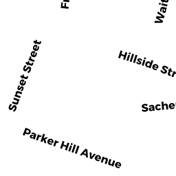
25A25 S HUNTINGTON AV
Owner Information
PAGOUNIS BESSIE
137 BALDPATE HILL RD
NEWTON, MA 02459


Property Details
25A25 S HUNTINGTON AV is classified as a IMPUTED - Commercial (Storage whse (old)).
The primary structure on this property was built in 1950. There are 2,998ft2 of built area within this property. There is 1,499ft2 of residential/living space within this property.
25A25 S HUNTINGTON AV is valued at $484,500. The land is valued at $190,000 and the structures are valued at $294,500.
The most recent deed for 25A25 S HUNTINGTON AV is recorded at the local registrar in Book 15633, Page 157. 25A25 S HUNTINGTON AV was last sold on Monday, June 19, 1989 for $200,000.
Assessment data from fiscal year 2020.
Flood Data
According to the FEMA National Flood Hazard Layer, this property does not appear to be in a flood zone. It may also be in an area not yet reviewed. Nonetheless, confirm this information prior to taking any action.
To view the flood hazards around this property, create a FEMA "Firmette" Map of the area around 25A25 S HUNTINGTON AV.
Broadband Internet Providers
| Provider | Type | Bandwidth (mbps) | |
|---|---|---|---|
| Starry, Inc. | Fixed Wireless | 200 | 200 |
| Comcast | Cable | 1000 | 35 |
| Verizon New England Inc. | DSL | 10 | 1 |
| Verizon New England Inc. | Fiber | 940 | 880 |
| VSAT Systems, LLC. | Satellite | 2 | 1 |
| HughesNet | Satellite | 25 | 3 |
| GCI Communication Corp. | Satellite | 0 | 0 |
| Viasat Inc | Satellite | 100 | 3 |
| T-Mobile | Fixed Wireless | 25 | 3 |
| netBlazr Inc | Fixed Wireless | 50 | 50 |
Broadband service provider data from December 2020.
Adjacent Properties
- 914 HUNTINGTON AV
IMPUTED - Commercial owned by GEORGE PAGOUNIS TRUST - 10 JAMAICAWAY ST 18
Residential Condominium owned by FADEL CHARLES KENT - 10 JAMAICAWAY ST 10
Residential Condominium owned by KADHIRESAN SUBATHRA - 10 JAMAICAWAY ST 28
Residential Condominium owned by YOUNG PHYLLIS M - 10 JAMAICAWAY ST 5
Residential Condominium owned by SETA FRANCESCA - 10 JAMAICAWAY ST 7
Residential Condominium owned by LU WENZHOU - 10 JAMAICAWAY ST 8
Residential Condominium owned by PARZYCH AMY - 10 JAMAICAWAY ST 9
Residential Condominium owned by FUENTES CYNTHIA E - 10 JAMAICAWAY ST 11
Residential Condominium owned by MERBL YIFAT HAYA - 10 JAMAICAWAY ST 12
Residential Condominium owned by SPARROW LAWRENCE - 10 JAMAICAWAY ST 12-A
Residential Condominium owned by FILLER RACHEL L - 10 JAMAICAWAY ST 14
Residential Condominium owned by OCONNELL JEANNE - 10 JAMAICAWAY ST 15
Residential Condominium owned by IVANCICH RICHARD - 10 JAMAICAWAY ST 16
Residential Condominium owned by ANDERSON MEREDITH - 10 JAMAICAWAY ST 19
Residential Condominium owned by SALTARES-DIAZ MYRIAM A - 10 JAMAICAWAY ST 20
Residential Condominium owned by EGAN THOMAS E - 10 JAMAICAWAY ST 21
Residential Condominium owned by NGUYEN CINDY M - 10 JAMAICAWAY ST 23
Residential Condominium owned by CASTILLO MORIS - 10 JAMAICAWAY ST 24
Residential Condominium owned by BURNS RICHARD - 10 JAMAICAWAY ST 26
Residential Condominium owned by CHISHOLM ALEXANDRA E S - 10 JAMAICAWAY ST 27
Residential Condominium owned by COBEY FREDERICK C - 10 JAMAICAWAY ST 29
Residential Condominium owned by GADECKI WALTER F - 10 JAMAICAWAY ST 30
Residential Condominium owned by FONAREV DMITRY - 10 JAMAICAWAY ST 31
Residential Condominium owned by CHOU HSIAO-LAN - 10 JAMAICAWAY ST 32
Residential Condominium owned by BERKSHIRE INVESTMENTS LLC - 10 JAMAICAWAY ST
Other, Open Space owned by TEN JAMAICAWAY CONDO ASSN - 10 JAMAICAWAY ST 1
Residential Condominium owned by FEBONIO ALEXANDER J - 10 JAMAICAWAY ST 1-B
Residential Condominium owned by TETTEH NII - 10 JAMAICAWAY ST 2
Residential Condominium owned by ESPIRITU MARIE - 10 JAMAICAWAY ST 4
Residential Condominium owned by RHODES HEIDI - 10 JAMAICAWAY ST 3
Residential Condominium owned by ZHANG YIYING - 10 JAMAICAWAY ST 6
Residential Condominium owned by LI WEI - 10 JAMAICAWAY ST 25
Residential Condominium owned by MEUCCI LOUIS M - 10 JAMAICAWAY ST 22
Residential Condominium owned by LIU CHARLES - 10 JAMAICAWAY ST 17
Residential Condominium owned by MATUNAS ERIC A - 29 S HUNTINGTON AV
Parking Lots - a commercial open parking lot for motor vehicles owned by PAGOUNIS BESSIE